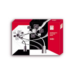
Spectrum Spatial Location Intelligence Module
New product
Software Spectrum Spatial Location Intelligence Module (Spectrum Spatial
Software Spectrum Spatial Location Intelligence Module (Spectrum Spatial LIM) is an additional component of the Spectrum geoinformation platform, it is an enterprise spatial data infrastructure server and is intended for collective work of an unlimited number of employees with cartographic data. Server Spectrum Spatial LIM Is based on a modern service-oriented architecture, contains all the necessary tools for creating, visualizing, analyzing and editing spatial information in various formats (spatial Oracle, Microsoft SQL, PostGIS and others, a wide range of file sources). Service Service (Feature Service)
Feature Service is a set of operations for unified access to data sources, a flexible mechanism for querying and searching for objects by any characteristics, as well as their combinations. Due to the geographical extension, the built-in SQL query language helps to perform selections taking into account the spatial relationships of objects, for example, remoteness, nesting, overlapping, intersections, etc. The main operations groups include the following:
Mapping Service is the visualization of cartographic data, construction of thematic maps and overlays. The main groups of operations:
Geometry Service is the execution of different geometric dimensions, transformations and operations:
MapTiling Service - is the generation of tiles based on raster and vector data. The built-in caching mechanism is provided, external cache connection is allowed (Squid, Apache, etc.). Support for external databases
Spectrum Spatial LIM Can work with all common types of spatial databases, including the ability to directly write and read spatial objects from Oracle, Microsoft SQL, PostgreSQL / PostGIS. Support for open GIS standards
Platform Spectrum Spectrum
Feature Service is a set of operations for unified access to data sources, a flexible mechanism for querying and searching for objects by any characteristics, as well as their combinations. Due to the geographical extension, the built-in SQL query language helps to perform selections taking into account the spatial relationships of objects, for example, remoteness, nesting, overlapping, intersections, etc. The main operations groups include the following:
- Get a list of all tables (data sources) in the repository.
- Obtaining a description of the attributive and spatial data of the table.
- Search (query) by distance, intersection, nearest object and inside the polygon.
- Arbitrary queries using the built-in MapInfo SQL language.
Mapping Service is the visualization of cartographic data, construction of thematic maps and overlays. The main groups of operations:
- Get a list of all maps, layers, styles, tables available in the repository.
- Methods for converting between geographic and screen coordinates.
- Measurement in screen coordinates, for example length.
- Visualization of maps and layers.
- Creation and visualization of thematic maps by different methods.
- Visualization of legends, watermarks, etc.
Geometry Service is the execution of different geometric dimensions, transformations and operations:
- Construction of derived geometric objects (buffer, centroid, MBR, union, etc.).
- Transformation of coordinates from different projections.
- Measurements: area, distance, length, perimeter, etc.
- Predicate (contains, intersects, inside, etc.).
MapTiling Service - is the generation of tiles based on raster and vector data. The built-in caching mechanism is provided, external cache connection is allowed (Squid, Apache, etc.). Support for external databases
Spectrum Spatial LIM Can work with all common types of spatial databases, including the ability to directly write and read spatial objects from Oracle, Microsoft SQL, PostgreSQL / PostGIS. Support for open GIS standards
Platform Spectrum Spectrum










.jpg)
.jpg)




.jpg)
.jpg)
